Severe Tropical Cyclone Narelle Approaches Western Australia Coast
Tropical Cyclone Narelle is currently tracking toward the Western Australia coast, with forecasts indicating it will make landfall as a severe category 3 system on Friday night. The storm's path is being closely monitored as it moves across the Indian Ocean, posing significant threats to coastal communities.
Forecasted Impact and Landfall Projections
The Bureau of Meteorology has issued warnings for wind gusts reaching up to 275 km/h near Exmouth later on Thursday, highlighting the cyclone's intensifying strength. Landfall is expected over the tourism town of Denham in Shark Bay, where residents are preparing for potentially destructive conditions.
This storm system originated in far north Queensland last week, traversed the Northern Territory, and has now traveled more than 5,500 kilometers across Australia to approach Western Australia. Cyclone Narelle is set to become the first storm in two decades to make landfall in three Australian states and territories.

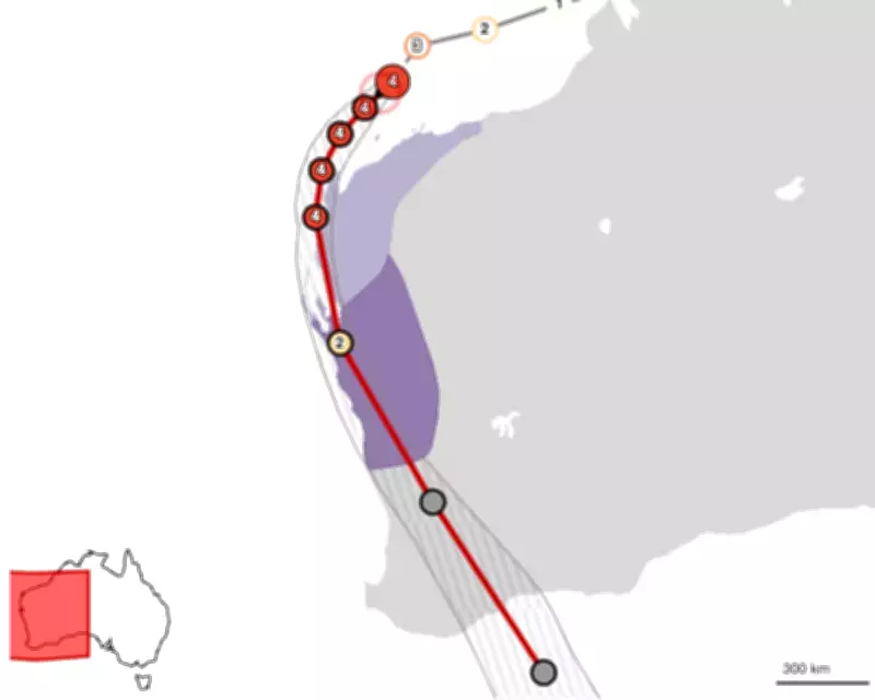
Tracking and Monitoring Resources
Meteorological authorities are providing regular updates through tracking maps that show Cyclone Narelle's expected path toward Perth and surrounding regions. The Bureau of Meteorology's Tropical Cyclone 34U forecast track map offers live updates on the storm's movement and intensity changes.
Residents in Western Australia are advised to stay informed through official channels as the situation develops. Emergency services are coordinating response efforts in anticipation of the cyclone's arrival, particularly in vulnerable coastal areas where storm surges and flooding may occur.
The storm's progression represents a significant weather event for Western Australia, with potential impacts on infrastructure, transportation, and local communities. Authorities emphasize the importance of following evacuation orders and preparedness guidelines as Cyclone Narelle approaches the coastline.