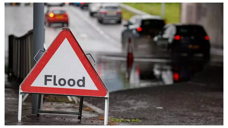
The Met Office has issued a series of yellow weather warnings for heavy rain across parts of the UK, raising significant concerns about potential flooding and widespread disruption. Southern England, Wales, and Northern Ireland are all forecast to be affected by torrential downpours from Monday through Tuesday, with the situation expected to evolve rapidly.
Detailed Timeline of Weather Warnings
The first yellow warning for rain is set to impact central and southern areas of Northern Ireland, including locations such as Enniskillen, Omagh, and Newry. This warning is active from midday on Monday until 6pm the same day. Forecasters have indicated that torrential downpours are likely to cause flooding in some places, leading to longer journey times and potential impacts on bus and train services. There is also a risk that some homes and businesses could be flooded as a result of the intense rainfall.
Expanding Warnings Across the UK
A second yellow warning for rain begins at 3pm on Monday and continues until midday on Tuesday. This warning affects the south west of England and areas further east, stretching almost to Portsmouth and extending as far north as Oxford. It also covers most of Wales, with the exception of the north and the west coast. In these regions, there is a heightened risk that some communities could become cut off due to flooded roads, and power cuts are considered a possibility.

On Tuesday, two additional yellow warnings come into effect. One for rain covers the south of England, east of Oxford and Portsmouth, and includes the whole of Kent. This warning runs from midnight until midday on Tuesday. Simultaneously, a yellow warning for both rain and wind has been issued for Northern Ireland, beginning at 2am on Tuesday and continuing until 9pm.
Expert Forecasts and Public Advice
Met Office chief forecaster Steve Willington commented on the unsettled conditions, stating: "Unsettled conditions will continue through the week, with a combination of rain, brisk winds and some further hill snow, particularly in northern areas where colder air remains in place. While many areas will see typical late January conditions, there is enhanced potential for some impactful weather on Monday night into Tuesday." He urged the public to stay informed with the latest forecasts and warnings as details develop.
Sky News weather producer Dr Chris England added that between 30mm and 80mm of rainfall is expected in affected areas over the coming days, which could exacerbate flooding risks. This follows recent severe weather events, such as Storm Ingrid, which caused damage in Devon, where part of the historic Teignmouth Grand Pier, built in 1865, was washed away.
Potential Impacts and Safety Measures
The Met Office has outlined several potential impacts from the heavy rain, including:
- Disruption to public transport services, with possible delays and cancellations.
- Flooding of homes, businesses, and roads, which may lead to isolated communities.
- Increased journey times due to hazardous driving conditions.
- Risk of power cuts in some areas, particularly where flooding affects infrastructure.
Residents in the warned regions are advised to take precautions, such as checking travel updates, securing property against flooding, and having emergency supplies on hand. The situation underscores the importance of heeding weather warnings and staying updated through official channels to ensure safety during this period of adverse weather.