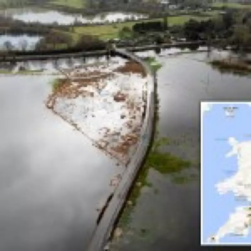
Almost 100 flood warnings have been activated across the United Kingdom as the nation braces for yet more wet weather, with forecasts predicting no immediate respite from the relentless downpours. The Environment Agency has escalated its alert system, issuing 80 flood warnings specifically for England, marking the second-highest category of risk. This signifies that flooding is highly probable, with the South West and Midlands regions expected to bear the brunt of the impacts.
Widespread Weather Alerts and Regional Concerns
Alongside the flood warnings, approximately 250 weather alerts have been disseminated across the UK, highlighting the extensive nature of the ongoing meteorological conditions. In Wales, authorities have issued 11 flood alerts, while Scotland is currently managing one flood warning accompanied by five additional alerts. The situation has grown particularly precarious in certain areas, such as Warwickshire, where the Fire and Rescue Service has expressed serious concerns about rising water levels in the River Dene, indicating that flooding could occur at any moment.
Understanding Flood Warning Triggers and Timing
These warnings are typically triggered by a combination of factors, including swollen rivers due to sustained rainfall, intense precipitation leading to flash floods, or coastal conditions exacerbated by high tides, storm surges, and strong winds. According to the Environment Agency, flood warnings are generally released between thirty minutes and two hours before flooding is anticipated to begin, providing a crucial window for preparedness and response.

Meteorological Insights and Historical Context
The Met Office has described the start of February as exceptionally wet, with continuous rainfall saturating the ground and elevating river levels across many parts of the country. Operational meteorologist Dan Stroud lamented that there's no end in sight to the gloomy conditions. Alex Deakin, another Met Office expert, attributed the persistent wet weather to a large area of high pressure that is stubbornly positioned, preventing any significant change in the forecast. He noted that this system, combined with the jet stream being situated far to the south, is also contributing to exceptional wet weather in Spain and Portugal.
Historical data reveals that the UK's wettest February on record occurred in 2020, with a staggering 213.7mm of rainfall, largely driven by the impacts of Storm Ciara and Storm Dennis. The current pattern of incessant rain has led many to feel that the new year has begun unusually damp, with precipitation occurring nearly every day so far.
Weekend Forecast and Broader European Weather Patterns
Looking ahead, the weather is set to remain unsettled over the coming days. Further rainfall is forecast for much of the UK, with gusty showers expected in the South West and particularly heavy downpours anticipated in South Wales. A yellow rain warning is currently active in Aberdeenshire, Scotland, until 9am tomorrow, with up to 30mm of rain possible on higher ground.
This UK weather situation mirrors broader climatic disruptions across Continental Europe. Last week, the region experienced a range of wild weather events, from devastating flooding and landslides in Portugal and Spain, caused by Storm Leonardo, to an Arctic blast affecting northern Europe. In Germany, dozens of flights were cancelled at Berlin Airport due to wintry conditions that created hazardous black ice on the tarmac.
As the UK grapples with this prolonged period of wet weather, residents are urged to stay informed through official channels and take necessary precautions to protect property and ensure personal safety. The combination of saturated ground, high river levels, and continued rainfall presents a significant and ongoing flood risk that requires vigilant monitoring and proactive community response.