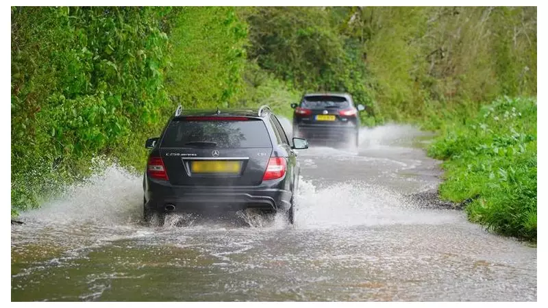
Communities across England and Wales are on high alert as dozens of flood warnings come into effect this weekend, with forecasters predicting significant rainfall that could lead to widespread disruption.
Widespread Weather Warnings in Force
The Environment Agency has issued 35 flood alerts for rivers across England, while Natural Resources Wales has implemented another 10 alerts as of midday on Saturday. These alerts indicate that flooding is possible and residents should remain vigilant.
This comes as the Met Office placed a yellow weather warning for rain covering the East Midlands, North East England, and Yorkshire and Humber throughout Saturday. Meteorologists predict up to 30mm of rain could fall fairly widely, with as much as 60mm possible over higher ground.

Further Disruption Expected on Monday
The weather system shows no signs of abating, with another yellow rain warning scheduled for Monday covering North West England, Hampshire, South West England and Wales. More substantial rainfall is anticipated, with up to 40mm likely across Derbyshire, North West England, and Yorkshire and Humber.
Particular concern focuses on the Cumbrian fells, where isolated spots could see an astonishing 120mm of rainfall. In South West England, forecasters warn of up to 50mm across the higher parts of Exmoor, Dorset, the Mendips and Cotswolds.
Most significantly, the Met Office has issued a more serious amber warning for rain in South Wales throughout Monday, with 120mm possible in some locations.
Potential Impacts and Travel Disruption
The Met Office has warned that homes and businesses could be flooded, with likely travel disruption and difficult driving conditions. The situation is particularly notable as England and Wales typically average just over 100mm of rainfall for the entire month of November – a figure that could be exceeded in just a few days in some regions.
Jason Kelly, chief meteorologist at the Met Office, explained: "While the exact track of the low remains uncertain at this time, there is a clear signal for strong winds and periods of heavy rain, which could lead to surface water flooding and delays to road and rail travel."
He added that rain pushing into North East England during Saturday "could fall as snow over higher ground" when meeting colder air from the north.
A brief respite is expected on Sunday, which should be drier and brighter for many areas, though colder with blustery winds near some North Sea coasts. Widespread frost is anticipated overnight into Monday before the next weather system approaches.
The weather follows recent disruption in Scotland, where homes were left without power following severe gales overnight. Gusts reached 83mph on the Western Isles and 75mph on the Isle of Mull, affecting around 1,000 properties before power was mostly restored.