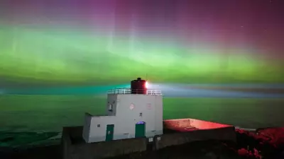
The United Kingdom is preparing for the coldest night of the year so far as temperatures plummeted to a bone-chilling -12°C in rural Scotland, with widespread disruption expected across the country.
Arctic Blast Brings Rare Thundersnow Phenomenon
Temperatures dramatically dropped on Thursday night, reaching -12°C in parts of rural Scotland while other regions across the UK fell below freezing. The severe cold snap has been accompanied by the rare weather phenomenon of thundersnow, which struck parts of north-east England.
Thundersnow occurs when heavy rainfall typically associated with thunderstorms instead falls as snow due to the extremely cold temperatures. This unusual event features heavy snowfall accompanied by the thunder and lightning normally seen during summer storms.
Meteorologists explain that thundersnow is particularly rare because it can only occur during the coldest months of the year when atmospheric conditions align perfectly.
Widespread Disruption and Health Alerts
Schools and transport networks face significant disruption as the sub-zero Arctic blast continues to affect the country on Friday. Icy roads, frost, and hazardous winter conditions are expected to persist throughout the day.
The UK Health Security Agency has issued an Amber Cold Health Alert that remains in force, focusing specifically on impacts for health and social care services across England. The alert highlights concerns for vulnerable populations during this extreme cold period.
Forecaster Simon Partridge provided insight into the conditions, stating: "It does look like we will have the coldest night of this winter so far, widely areas are below freezing."
He explained that the primary reason for the extreme cold is "a little ridge of high pressure moving across the UK overnight tonight" combined with much lighter winds compared to previous nights.
Weather Relief Expected Over Weekend
Despite the morning frost affecting much of the country, Mr Partridge indicated that Friday represents the end of the severe cold spell. He added: "Friday is really the end of the really cold weather as things turn back to average by the time we get into the weekend."
The Met Office forecasts a shift to milder, more unsettled Atlantic-driven weather patterns ahead of the weekend. This transition will bring:
- Increased cloud cover and rainfall
- Some stronger winds at times
- A reduction in wintry hazards
- Gradually rising temperatures toward seasonal averages
For many areas, Friday will be predominantly dry with temperatures slowly turning milder, though rain is expected to reach western regions later in the day.
The Met Office specifically mentioned monitoring Wales and the Midlands, where saturated ground conditions may increase the likelihood of low impacts from the continuing chilly conditions.
Looking further ahead, forecasters anticipate a gradual settling trend next week, with north to northeasterly winds confining rain and showers increasingly to eastern areas. Cooler air arriving in the north may develop some wintry conditions in extreme northern parts by Monday's end.


