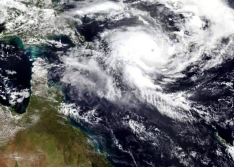
Severe Tropical Cyclone Maila Intensifies to Category Five, Threatening Queensland Coast
Severe Tropical Cyclone Maila has rapidly intensified to a category five storm over the Solomon Sea, marking it as one of the strongest systems of the current Australian cyclone season. The storm is forecast to make landfall along the far north Queensland coast early next week, bringing with it substantial risks of heavy rainfall, potential flooding, and hazardous surf conditions.
Impending Landfall and Historical Context
According to the Bureau of Meteorology, Maila is expected to cross the Cape York peninsula, likely impacting areas between the Lockhart River and Cairns. This comes just weeks after Severe Tropical Cyclone Narelle, a category four system, buffeted the same region in March. Maila has recorded a lower minimum pressure of 924hPa compared to Narelle's 930hPa, indicating greater intensity and potential for more severe weather effects.
Senior meteorologist Ilana Cherny noted that while the cyclone will weaken as it moves south-west towards Australia, uncertainties remain regarding its exact path and strength. Communities in Queensland could begin experiencing impacts from the weekend onwards, with already-saturated catchments heightening flood risks.

Regional and Global Cyclone Activity
Maila is the seventh storm to reach severe tropical cyclone strength—above category three—this Australian cyclone season, which runs from November to April. Historically, data since 1980 shows that of the average ten tropical cyclones in the Australian region each season, only three or four typically make landfall, with about five reaching severe intensity. Cherny highlighted that Maila is likely to be the seventh tropical cyclone to make landfall on the Australian mainland this season and the third to cross the Queensland coast.
Simultaneously, another major storm system, Severe Tropical Cyclone Vaianu, is expected to impact New Zealand around the same time as Maila hits Australia. Vaianu, currently a category three system near Fiji, is forecast to transition into an extra-tropical cyclone and track towards New Zealand's North Island, potentially bringing damaging winds.
Environmental Impacts and Scientific Insights
The effects of Cyclone Maila are already being felt in the Solomon Islands, with social media images showing property destruction in remote provinces. Professor Liz Ritchie-Tyo from Monash University explained that cyclones like Maila and Narelle form near the equator and are steered westward towards Australia by specific circulation patterns.
She also pointed out that while global heating is expected to reduce cyclone frequency, those that do form are likely to be more intense. Preliminary observations suggest cyclones may be moving slower, leading to prolonged effects upon landfall and slower weakening, which underscores the importance of adaptation strategies for communities at risk.
As authorities monitor Maila's progression, residents in far north Queensland are advised to stay informed and prepare for potential severe weather conditions in the coming days.