UK Weather Set for Weekend Relief with Temperatures Reaching 16°C
After enduring weeks of relentless rain, wintry conditions, and multiple yellow weather warnings, the United Kingdom is finally poised for a significant meteorological reprieve. The Met Office has announced that this weekend could see temperatures climb to highs of up to 16°C, marking a welcome shift from the recent unsettled patterns.
Warnings Expire but Icy Conditions Persist in Wales
Three separate yellow weather warnings expired this morning, signaling the beginning of a gradual improvement. However, forecasters caution that icy stretches are still expected across much of Wales as temperatures dip close to or below freezing overnight. Slippery pavements and road surfaces remain a hazard, urging residents to exercise caution during the early morning hours.
Chief Met Office forecaster Jason Kelly provided detailed insights into the transitional phase. "There is potential for rain, sleet, and snow to affect parts of Wales, central England, and the southern Pennines from Wednesday evening into early Thursday," he stated. "Strong east to northeasterly winds could increase impacts, and ice is also a risk as temperatures drop overnight."

Kelly emphasized the importance of staying informed, noting, "We are keeping a close eye on how this weather system evolves, so do be prepared for weather warnings to change and stay up to date with the weather forecast in your area."
Understanding the Recent Deluge: A Meteorological Traffic Jam
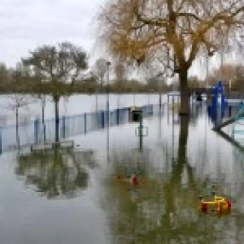
The persistent rainfall has left many questioning its causes. According to Met Office data, the UK recorded 17% more rainfall than usual last month, with little sign of abatement until now. The explanation lies in a complex atmospheric setup often described as a meteorological traffic jam.
A vast area of high pressure over Scandinavia has acted as a weather roadblock, disrupting the typical eastward movement of weather systems. This has caused low-pressure, wet, and cloudy conditions to stall above Britain, leading to extended periods of consecutive rain. In some areas, such as North Wyke in Devon and Cardinham in Cornwall, as many as 40 days of rain have been recorded.
The consequences have been severe, with constant showers falling on already-saturated ground, contributing to devastating floods in regions like Somerset and Devon. Statistics reveal that England alone experienced 59% of its expected February rainfall within the first nine days of the month. Further south, Worcestershire and the Isle of Wight received their typical February precipitation in just one week.
Looking Ahead: A Gradual Improvement
Despite the lingering icy conditions in Wales, the overall weather pattern is expected to slowly improve throughout the morning. Temperatures are forecast to turn milder for the time of year by the weekend, offering a much-needed break from the recent onslaught. This shift promises to bring relief to residents and communities affected by the prolonged wet weather.
As the UK transitions into this warmer phase, authorities continue to monitor developments closely, ensuring that updates are provided to keep the public safe and informed. The weekend's anticipated highs of 16°C symbolize a hopeful turn in what has been an exceptionally rainy period.