Storm Regina unleashed its fury on the Canary Islands this week, with powerful gusts reaching up to 64 miles per hour and massive waves crashing into coastal areas. The storm, named by the Portuguese weather service, swept eastwards towards Africa on Tuesday and Wednesday, causing widespread disruption across the archipelago.
Impact on the Canary Islands
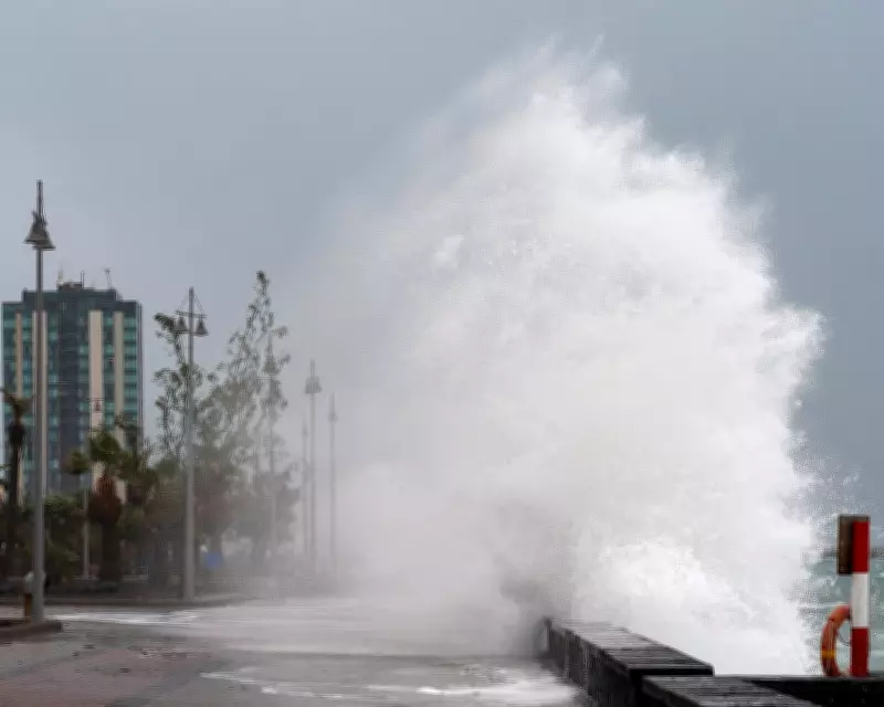
In Lanzarote, a promenade was battered by waves, a scene reminiscent of a similar event in November. Wave heights were widely reported at 5 to 6 meters, with some peaks exceeding 6 meters along the northern coasts. As a result, authorities issued a yellow warning for rough seas, urging residents and tourists to exercise caution.
Adding to the chaos, snowfall struck elevations above 1,500 meters in Tenerife, leading to the closure of multiple mountain roads. This unusual weather combination of high winds, rough seas, and snow highlights the severe impact of Storm Regina on the region.

Contrasting Weather in the United States
Meanwhile, the winter of 2025/26 in the United States has been marked by stark contrasts. Multiple intrusions of Arctic air engulfed large parts of the country, bringing record snowfall and weeks of sub-zero temperatures. Rhode Island, for instance, recorded nearly 38 inches (96 centimeters) of snow in just 48 hours during a blizzard last month.
However, this week saw a dramatic shift. Warm air surged northwards from Mexico, pooling over Texas, Arizona, and California. In Falcon, Texas, a temperature of 41°C (106°F) was recorded, preliminarily breaking the record for the warmest temperature ever recorded in the U.S. during the meteorological winter months of December, January, and February.
Record Warmth and Drought Conditions
Despite the Arctic outbreaks in the eastern half of the country, record warmth in the west contributed to the season being the second warmest winter on record when averaged across the nation. Southern states like Florida experienced a very dry winter, with many areas entering spring under severe or extreme drought conditions, according to the National Drought Mitigation Centre.
Future Outlook: El Niño Event
There is hope on the horizon, as the latest forecast models indicate the development of an El Niño event later this year. El Niño occurs when waters in the equatorial part of the Pacific Ocean become warmer than normal, and it is part of the El Niño Southern Oscillation, which also includes the cooler La Niña phenomenon.
When an El Niño is present, Florida's rainy season is often amplified due to increased tropical moisture and storm activity in the eastern Pacific Ocean. This could provide much-needed relief from the current drought conditions.
The extreme weather events in both the Canary Islands and the United States underscore the unpredictable nature of global climate patterns and the importance of preparedness and monitoring.