UK Weather: Temperatures Soar to 19°C Today, But Rain Returns Tomorrow
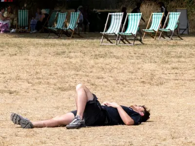
Britons across the United Kingdom are waking up to the warmest day of the year so far, with clear skies and sunshine gracing much of the country. A gentle breeze originating from southern Europe has ushered in significantly warmer conditions, providing a welcome respite from the relentless rainfall that has drenched the nation in recent weeks.
Today's Warm Spell
The southeast of England is poised to experience the peak of this warm spell, with temperatures expected to climb to a balmy 19°C today, potentially even exceeding that mark. Inland areas away from the cooling influence of the coast are also forecast to enjoy pleasant warmth, with temperatures hovering around 16°C. This surge in warmth marks a dramatic shift from the soggy and dull weather patterns that have dominated the winter months.
Impending Change
However, this sunny interlude is set to be short-lived. While much of England and Wales bask in the warmth, Scotland and Northern Ireland are already seeing increasing cloud cover and rainfall today. This unsettled weather is predicted to sweep southwards across the entire UK by tomorrow, bringing a swift end to the current warm spell.

Forecast for the Coming Days
Temperatures are expected to dip noticeably tomorrow, falling to a cooler range of 8°C to 11°C for most regions. If residents in the southeast are fortunate, they might still see highs reaching around 14°C. Looking ahead to next week, further spells of rain are anticipated, although temperatures should remain slightly above average for this time of year, with potential highs of 15°C. Forecasters also warn of foggy and chilly nights in the coming days.
Expert Commentary from the Met Office
Tony Wisson, Deputy Chief Forecaster at the Met Office, provided insight into the changing conditions. "This week marks the beginning of meteorological spring, and the forecast is set to reflect this seasonal transition," he stated. "Over the next few days, conditions are likely to become noticeably more settled, offering a welcome change from the recent unsettled weather. We will see a band of rain cross the country on Thursday, and spells of rain or showers may continue to come and go across Northern Ireland and western Scotland over the coming days. We're looking at a slightly warmer week, with highs of up to 19°C on Thursday."
Context of a Wet Winter
This warm spell arrives after what has been one of the wettest winters on record for many parts of the UK. The Met Office attributes the persistent rainfall to a succession of low-pressure systems. In conditions of low air pressure, warm air rises, cooling the area and causing water vapour to evaporate and form clouds and precipitation. The UK has already weathered two named storms this season: Storms Ingrid and Chandra.
Dr. Amy Doherty, Science Manager at the Met Office, elaborated on the winter's extremes. "February's mild and notably dull conditions have brought a winter of considerable contrasts to a close. While February itself stood out for its exceptionally low sunshine and above-average temperatures, the broader winter picture shows just how varied conditions have been around the UK. Some southern and central areas of the UK experienced persistent rainfall, leading to saturated ground and several areas recording one of their wettest winters on record."
Residents are advised to make the most of today's sunshine, as cooler and wetter weather is firmly on the horizon for the remainder of the week and into the weekend.