UK's Relentless Rainfall Explained: Meteorological Traffic Jam Causes Flooding
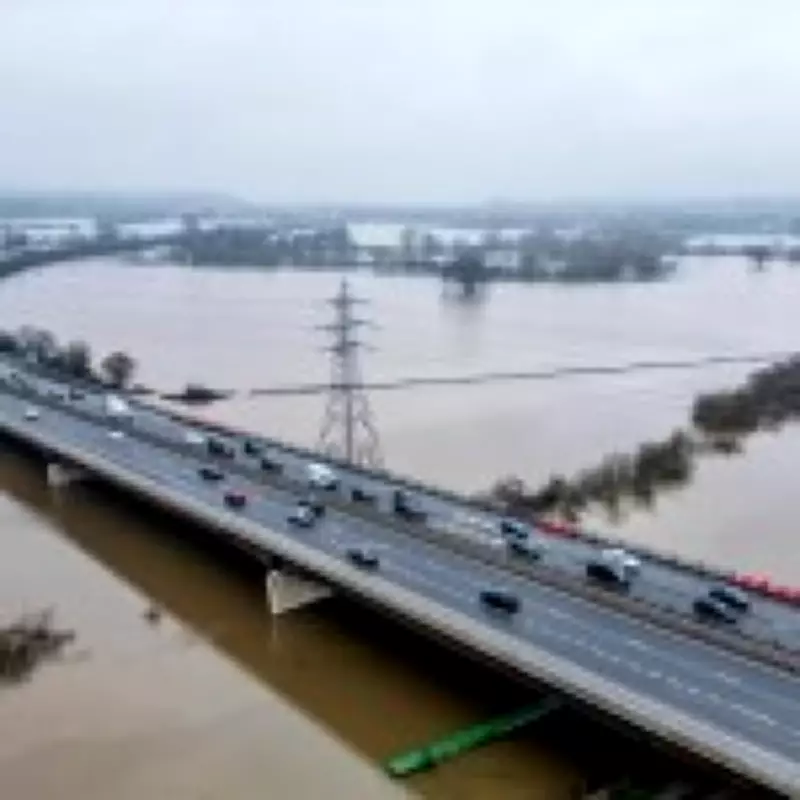
The United Kingdom has experienced a profoundly wet start to 2026, with January ranking among the wettest months on record. According to the Met Office, the country recorded 17% more rainfall than the typical average for January, and the deluge shows little sign of abating. With three major storms already hitting in 2026, the nation is on high alert for further flooding, as evidenced by 101 flood warnings and 160 alerts issued on a recent Tuesday morning. The Met Office forecasts that this persistent rain is likely to continue for another seven to ten days, raising urgent questions about the underlying causes of this extreme weather pattern.
What Is Causing This Unending Downpour?
The UK is currently trapped in what meteorologists describe as a "weather traffic jam." A vast area of high pressure over Scandinavia is acting as a formidable block, preventing the usual eastward movement of weather systems across the British Isles. Typically, low-pressure systems bringing wet and cloudy conditions would pass through relatively quickly. However, this January, these systems have stalled over the UK, leading to as many as 40 consecutive days of rain in some regions, such as North Wyke in Devon and Cardinham in Cornwall.
The constant showers have fallen on already saturated ground, exacerbating flooding incidents in areas like Somerset and Devon. In England alone, 59% of the expected rainfall for the entire month of February was recorded in just the first nine days. Further south, locations including Worcestershire and the Isle of Wight have received their typical February rainfall in a single week, highlighting the intensity of the precipitation.

Why Do These Blocked Weather Patterns Occur?
These stagnant weather conditions are primarily driven by shifts in the jet stream, the fast-moving air currents in the upper atmosphere. Normally, the jet stream flows from west to east across the Atlantic, with minor undulations that generate weather systems. However, when these undulations become amplified, the jet stream's path meanders significantly, resembling a winding river. This slaloming pattern can lead to the buildup of high-pressure areas that obstruct the jet stream's flow, resulting in prolonged periods of unchanged weather. Consequently, regions on the ground endure weeks of relentless rain without relief.
When Will the Rain Finally Cease?
There is some hope that this stubborn weather pattern may begin to dissipate by the end of this week. Forecasts indicate that low pressure could push eastward on Saturday, potentially bringing a brief spell of sunshine to parts of southern England. However, this shift is also expected to introduce colder temperatures, wintry showers, and even snowfall in certain areas. Regions such as Suffolk, Norfolk, Lincolnshire, Yorkshire, and the North East might experience snow flurries, while southern England is likely to avoid snowfall. In contrast, areas including Cumbria, Northumberland, Lancashire, North Yorkshire, and much of Scotland could be hit by snow.
Looking ahead to next week, the UK should prepare for more unsettled weather, with additional spells of rain anticipated and warnings of localized flooding remaining in place. The combination of ongoing precipitation and potential snow underscores the need for continued vigilance and preparedness across the nation.