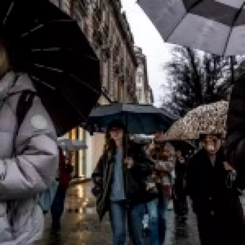
Relentless Rainfall Continues Across the United Kingdom
For many residents across the United Kingdom, the start of 2026 has been characterised by an unending deluge, with rainfall recorded every single day so far this year. This persistent wet weather has led to widespread frustration, echoing the sentiments of the classic nursery rhyme pleading for the rain to go away. The meteorological conditions have prompted official action, with the Met Office extending a yellow weather warning for rain until 9pm today.
Active Weather Warnings and Forecast Details
The current alert specifically covers central Wales, where forecasters anticipate approximately 10mm of rainfall, with some isolated locations potentially experiencing double that amount. Simultaneously, Northern Ireland is under a similar yellow warning, active until the end of the day, with predictions of up to 80mm of rain. These warnings highlight the intensity and geographical spread of the ongoing precipitation.
Looking ahead to Friday, the Met Office indicates that rain will greet many parts of the country at dawn. Northern regions are expected to face windy conditions accompanied by possible hill snow, while western Scotland may enjoy the driest and brightest conditions. This pattern underscores the variability yet overall dominance of wet weather across the nation.

Expert Analysis on the Weather Patterns
To understand whether this rainfall will ever cease, Metro consulted Jim NR Dale from the independent meteorological organisation, British Weather Services. Dale provided a sobering outlook, stating, ‘There will be drier or even the odd dry day going forward, but for the most part, the rain continues.’ He forecasts that between 40 and 100mm of rain will soak the UK by mid-February, maintaining the damp conditions.
However, a shift is anticipated from February 12, particularly in Scotland and northern areas, due to a phenomenon known as polar vortex dislocation. Dale explains, ‘Snow instead of rain. Colder and icy weather then follows, but still with rain when it isn’t snow!’ A polar vortex refers to a high-altitude, fast-moving air band that traps cold air over the Arctic, and its dislocation can lead to significant temperature drops and precipitation changes.
Causes and Broader Climate Context
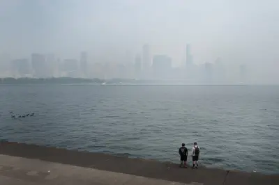
The Met Office attributes this year's excessive rainfall to a series of low-pressure systems. In low-pressure conditions, warm air rises, cooling the area and causing water vapour to evaporate and form clouds and rain. This mechanism is not unique to the UK; similar patterns have caused major floods in Spain and Portugal during Storm Leonardo, as noted by Dale.
The UK has already experienced two named storms this year—Storms Ingrid and Chandra—reflecting the severity of the weather. Dale connects these events to broader environmental trends, adding, ‘It’s what we can now expect from climate change fallouts.’ This statement underscores the increasing frequency and intensity of such weather phenomena linked to global climate shifts.
When Will the Rain Finally Stop?
According to Dale, once the current low-pressure system moves away, the weather should return to a more typical pattern, with rain that ‘stops and starts’ rather than falling continuously. However, he cautions that a significant change requires high pressure to establish itself over the region. ‘Really and truly, we are waiting on high pressure to get a fix over us,’ Dale says, noting that this is unlikely until well beyond mid-February, possibly in the final quarter of the month.
In summary, while brief respites may occur, the UK is set for continued rainfall in the near term, with potential snow later in February. Residents are advised to stay updated with Met Office warnings and prepare for variable conditions as the weather evolves.