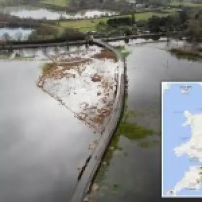
Following one of the wettest Januarys ever recorded, the United Kingdom is now preparing for a brief but intense cold snap, accompanied by a heightened likelihood of snowfall. The Met Office has activated yellow weather alerts for snow and ice, covering extensive areas of Scotland and northeastern England from Thursday through Friday. Meteorologists predict that certain regions could accumulate up to 10 centimeters of snow, with icy conditions posing risks to travel safety and motorist security. Simultaneously, southern England is anticipated to experience a sharp decline in temperatures, raising questions about potential winter disruptions.
Where Is Snow Expected Across the UK?
A significant portion of northern England, spanning from Manchester to Newcastle and including Carlisle and York, is under a yellow weather warning for snow and ice. This alert is effective from 7 PM on Thursday until 12 PM on Friday. Authorities have cautioned residents to remain vigilant for icy patches on roadways, which may lead to delays and hazards for both road and rail networks.
Scotland's Snow and Ice Alert Details
Scotland is also subject to a snow and ice warning, active from 4 PM on Thursday until 12 PM on Friday. Forecasts indicate that settled snow could range from 1 centimeter at lower elevations to as much as 10 centimeters in higher areas. Travel disruptions are expected, along with icy conditions on untreated roads and pathways. The Met Office elaborated, stating that rain will transition to snow over elevated hills initially, with snowfall descending to lower levels by Thursday evening. Accumulations are primarily anticipated above 200 meters, where 2 to 5 centimeters are possible, and above 300 meters, some locations might see up to 10 centimeters. The precipitation is projected to clear southward early Friday, with temperatures plummeting rapidly as skies clear, resulting in ice formation on untreated surfaces.
Wales may encounter light snowfall, though any accumulation is expected to be minimal. In contrast, southern England, including London, is unlikely to experience significant snow. After a relatively mild Wednesday with temperatures reaching 12 degrees Celsius in London, a drop is forecasted for Thursday night, leading to chilly mornings of 4 degrees Celsius on Friday and 1 degree Celsius on Saturday. Instead, the region is bracing for continued rainfall until Friday.
Will London or Southern England See Snow?
Tom Morgan, a forecaster at the Met Office, provided clarity on the situation for southern areas. He noted, "Unfortunately for snow enthusiasts, the precipitation will predominantly be rain. From Friday afternoon into the evening, there might be some snow mixed with rain, but at best, it could result in a slushy centimeter—depending on one's perspective." The focus remains on a substantial band of wet weather gathering in the Atlantic on Saturday, which is set to sweep across the UK on Sunday.
Flood Warnings and Weather Outlook
As of Wednesday afternoon, England had 82 flood warnings, indicating expected flooding, and 148 flood alerts, signaling possible flooding. Many of these are concentrated in Devon and Wiltshire, regions already impacted by successive storms. Despite the generally bleak forecast, Morgan offered a silver lining for Londoners weary of persistent rain: "There is a sunny day expected on Sunday, so make the most of it." This brief respite may provide relief amid the ongoing wet and cold conditions.


