Britain and Ireland have been battered by severe weather as Storm Chandra swept across the nations, unleashing torrential rain and powerful winds that have led to significant flooding, widespread travel chaos, and numerous school closures. Multiple weather warnings remain in force, with amber alerts highlighting the most dangerous conditions in specific regions.
Widespread Flooding and Travel Disruption
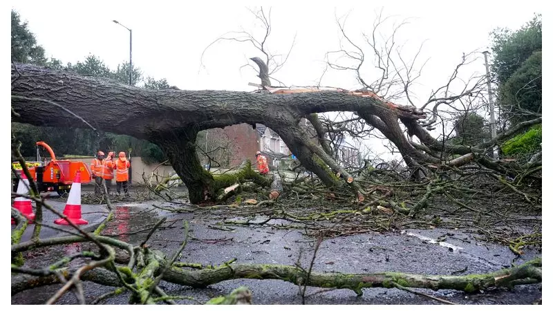
Early on Tuesday, more than 100 flood warnings were active across England, with the majority concentrated in the southwest. The Met Office has issued a yellow wind warning for Devon and Cornwall, predicting likely travel disruption, potential power cuts, and possible damage to buildings as large waves lashed the coastline. In Houghton-le-Spring, Durham, Hall Lane was rendered impassable due to fallen trees, illustrating the storm's destructive force.
Regional Impacts Across the UK
Further north, drivers faced additional hazards from snow, with blizzard-like conditions closing roads in some locations, particularly in the north Pennines. In York, the River Ouse burst its banks, submerging Kings Staith and causing extensive flooding in the area. The Scottish borders remained under a yellow rain warning, with heavy downpours threatening further power disruptions and transport delays.

In the Birmingham area, fords on Houndsfield Lane and Green Road were so swollen by floodwaters that the underlying tarmac became completely invisible, making these routes treacherous and impassable for vehicles.
Ireland Bears the Brunt of the Storm
Some of the most dramatic scenes emerged from Ireland, where roads and rivers became indistinguishable, leaving cars submerged and communities isolated. In Enniscorthy, County Wexford, multiple routes were closed as civil defence crews worked tirelessly to pile up sandbags in affected areas. One family living on Enniscorthy Quay had to be evacuated by boat, according to reports from the Irish Independent.
The relentless downpour also left more than 1,000 people without power across the county. Footage from Dublin showed streets transformed into flowing rivers, with floodwater inundating urban areas. Met Éireann, Ireland's meteorological service, issued a yellow rain warning for the southeastern counties, forecasting heavy and persistent rain on already saturated ground and near-full rivers.
Official Warnings and Safety Advice
Meteorologist Rebecca Cantwell from Met Éireann emphasised the dangers, stating: "The winds will be strongest near coasts and exposed areas with wave overtopping possible and so we echo the well-known advice of the Irish Coast Guard: 'stay back, stay high, stay dry'." This advice underscores the critical need for public caution during such extreme weather events.
Storm Naming and Future Outlook
Storm Chandra is the latest storm to be named by the western Europe storm naming group, a collaborative list shared between the UK, Ireland, and the Netherlands. The Met Office indicates that the storm is expected to gradually move away westwards over Tuesday night and into Wednesday, offering some respite from the severe conditions.
As communities across both nations assess the damage and begin recovery efforts, the impact of Storm Chandra serves as a stark reminder of the power of nature and the importance of heeding weather warnings to ensure public safety.