Welling, a suburb in south-east London, has transformed from a small village into one of the largest shopping centres in the London Borough of Bexley, with its High Street now stretching almost a mile and housing more than 250 shops and businesses. This change took centuries, shaped by an ancient Roman road and the arrival of the railway in 1895.
From ancient manor to coaching stop
Welling's history dates back hundreds of years, originally forming part of the ancient manor of East Wickham. The name "Wellyngs" appears in a document from 1362 and is believed to come from an Old English word meaning "the place of the spring." Despite this long history, Welling remained extremely small for many years. A map from 1769 shows only a few buildings on either side of the road, surrounded by farms, fields, and open heathland.
The road itself was much older, following what is now Welling High Street and Bellegrove Road, tracing the route of Watling Street. This major Roman road connected London with Kent and ultimately Dover. While the route was formalised during the first century AD, archaeological evidence suggests there might have been an earlier trackway before the Romans.
A crucial stopping point between London and Kent
Welling's position on the main road between London and Dover gradually became key to its development. Before the railway, the village was a traditional staging post for coaches travelling between London and Kent. Coaching inns sprang up along the road to cater to travellers, with historic establishments such as the Guy, Earl of Warwick, and the Nag's Head forming the nucleus around which Welling developed. Shops and other businesses gradually appeared alongside them.
Agriculture also played a significant role in the local economy, particularly market gardening, with large areas around Welling used for growing produce. Historic maps from the late 19th century show a relatively small settlement concentrated along the old Dover Road, surrounded by large areas of undeveloped land.
The railway revolution
One of the most significant turning points came in 1895 when the Bexleyheath railway line opened. Welling station was built towards the western end of the centre, making journeys towards London and Dartford considerably easier. Bexley Council's Local Character Study indicates the High Street subsequently began extending westwards from Upper Wickham Lane, particularly during the inter-war period.
The railway made Welling a viable place for people who wanted to live outside central London while still commuting into the city. The transformation sped up dramatically after the First World War. Between 1920 and 1926, Bexley Urban District Council built 426 homes north of the railway as part of the Welling Council Housing Scheme. Meanwhile, the sale of land belonging to the Danson Estate opened up areas south of Watling Street to private housebuilders.
During the 1930s, further estates were constructed around Welling and neighbouring Falconwood. Fields and orchards increasingly gave way to new streets of suburban homes. A comparison of maps from 1897 and 1933 shows just how dramatically Welling expanded within just over three decades.
The growth of Welling High Street
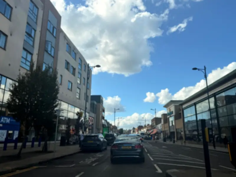
All those new residents needed somewhere to shop. Parades of shops were built along the main road as the surrounding population increased, helping to transform the old coach route into the long shopping centre seen today. Bexley Council says the area's historic connection to Watling Street explains Welling's distinctive linear shape, with development stretching along the road instead of being concentrated around a traditional town square.
The modern town centre encompasses Welling High Street, Bellegrove Road towards the railway bridge, and part of Upper Wickham Lane. Welling itself remained part of Kent until the creation of the London Borough of Bexley and Greater London in 1965. Despite decades of redevelopment, the suburb's earliest history can still be spotted along the High Street. Bexley Council says the nearly mile-long shopping area now contains more than 250 outlets alongside several historic buildings.
There is also the distinctive Russian cannon at Welling Corner, a Crimean War-era weapon on loan from the Royal Artillery Museum in Woolwich. Today, supermarkets, restaurants, takeaways, and independent businesses line the route once used by Roman travellers and horse-drawn coaches. While Welling is now firmly part of suburban south-east London, the shape of its busy High Street is still largely the result of the ancient road around which the tiny village first grew.