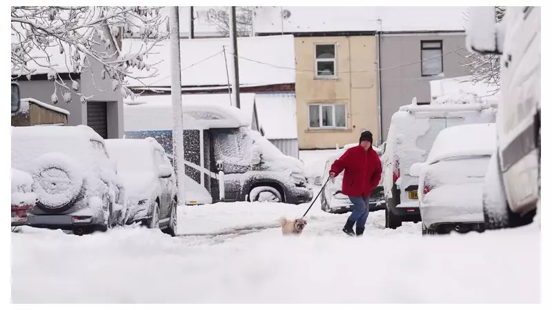
The UK is grappling with a significant cold snap as the Met Office has issued a series of amber and yellow weather warnings for snow and ice, causing widespread disruption and hazardous travel conditions.
Widespread Warnings and Snowfall Totals
Updated warnings were issued on Wednesday morning, covering parts of East Anglia and the South West. The cold Arctic air has already delivered substantial snowfall across the nation. Met Office weather stations recorded 7cm of lying snow in Lake Vyrnwy, Powys, and 5cm in Lerwick, Shetland. Other affected areas include the Scottish Highlands, with 7cm in Altnaharra and 4cm in Loch Glascarnoch, as well as parts of Northumberland and Lanarkshire.
Forecasters warn that some regions could see accumulations of 15-25cm of snow, particularly on higher ground. The Met Office has explicitly stated that this wintry weather could create "particularly tricky travel conditions" and may lead to vehicles and passengers becoming stranded.

Detailed Breakdown of Weather Alerts
A complex system of warnings is in place across the UK. An amber weather warning for snow is active for parts of Yorkshire from 3am to 9pm on Thursday. This alert warns of significant snow accumulations from frequent wintry showers feeding inland from the North Sea, primarily affecting the North York Moors and Yorkshire Wolds.
Multiple yellow warnings for snow and ice are also active:
- Northern Scotland: Until 9pm on Thursday.
- East Anglia: From 5pm Wednesday to 11am Thursday.
- Cornwall, parts of Devon, and West Wales: From midday Wednesday to 11.59pm Thursday.
- Northern and northeastern England and southeastern Scotland: From midnight Wednesday to 11.59pm Thursday.
- Northern Ireland: Was in place until midday Wednesday.
Disruption, Warnings, and a Glimmer of Milder Weather
The Met Office has cautioned that the expected snow accumulations are likely to cause "substantial disruption", including probable power cuts and significant travel delays. Temperatures are forecast to plummet, potentially reaching as low as -11°C in parts of Scotland on Thursday night.
Darren Clark of National Highways urged motorists to prepare, stating, "We're urging drivers to prepare for winter, and not be caught out by it." He highlighted that over 530 gritters are available and advised drivers to top up fuel and screenwash, and check tyres and lights.
Met Office Chief Forecaster Neil Armstrong confirmed, "Cold Arctic air from the north is firmly in charge of the UK's weather, bringing the first notable cold snap of this autumn." While ice will remain a hazard, conditions are expected to turn drier for many by Friday, with milder temperatures and rain arriving in western areas later in the day.