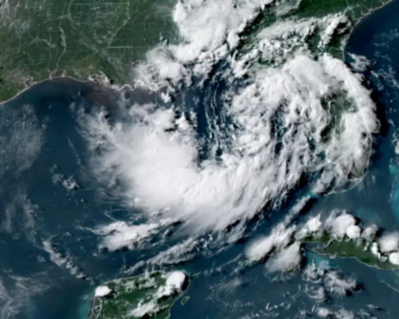
A tropical depression developing along the US Gulf coast is expected to strengthen into a tropical storm later on Monday, according to the National Hurricane Center (NHC) in Miami. The system was centered about 120 miles south of Panama City, Florida, and 215 miles southeast of Mobile, Alabama, as of 10 a.m. local time, with maximum sustained winds of 35 mph and higher gusts.
Watches Issued for Gulf Region
The NHC issued a storm surge watch from the Alabama-Florida border westward to the mouth of the Mississippi River in Louisiana. A tropical storm watch extends from the Mississippi-Alabama border to the line separating Louisiana’s Jefferson and Plaquemines parishes. The depression is expected to move near or along the northern Gulf coast over the next several days.
Risk of Life-Threatening Flooding
The storm surge watch indicates a risk of life-threatening coastal flooding from rising water moving inland within the next 48 hours. Combined with high tide, storm surge could flood normally dry coastal areas along parts of the northern Gulf coast. Water levels could rise by 2-4 feet (60-120 cm) from the mouth of the Mississippi River to the Alabama-Florida border, with 1-3 feet of surge possible across portions of coastal Louisiana and Florida, including Lake Pontchartrain.

The depression is also expected to produce widespread rainfall totals of 2-4 inches, with isolated amounts of up to 8 inches through Friday from western Florida to the middle Texas coast. Heavy rain could trigger flash flooding in some areas, and an isolated tornado or two is possible across Florida’s Big Bend region.
Tropical Storm Fausto Strengthens in Pacific
Meanwhile, Tropical Storm Fausto continues to strengthen over the eastern Pacific. As of Monday morning, the storm was moving west-northwest at about 13 mph with maximum sustained winds of 65 mph. It is forecast to become a hurricane later Monday, with additional strengthening expected over the next few days. No coastal watches or warnings are in effect for Fausto, but swells from the storm are expected to reach the west coast of the Baja California Peninsula on Wednesday and persist for several days, creating life-threatening surf and rip current conditions. Fausto is forecast to continue tracking west-northwest through Wednesday.