Met Office Activates Yellow Snow Warnings as Arctic Blast Hits UK
The Met Office has officially issued yellow weather warnings for snow and ice across substantial portions of the United Kingdom, following a significant drop in temperatures. After enduring weeks of persistent rainfall, residents are now bracing for a shift to wintry conditions, with forecasters predicting potential travel chaos and hazardous driving situations.
Widespread Snow and Ice Alerts Issued
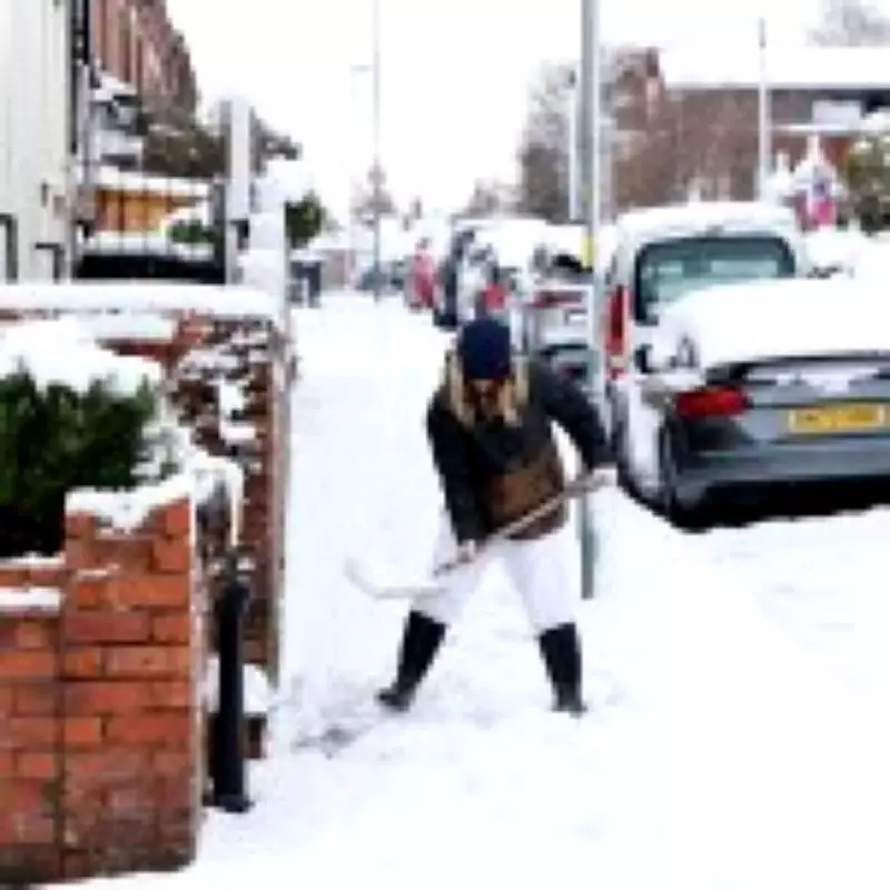
A comprehensive yellow weather warning, which remains active until midday today, covers northern England and the north Midlands. This alert specifically warns of a mix of rain, sleet, and snow impacting major urban centers including Manchester, Sheffield, Leeds, York, Middlesbrough, Newcastle, and Carlisle. Authorities are urging extreme caution due to the high likelihood of icy patches forming on roads and pavements, which significantly increases the risk of accidents.
While snow-covered landscapes may appear picturesque, the Met Office emphasizes that the primary concern is the transformation of roads and railway lines into dangerous ice rinks, leading to inevitable travel disruption. Concurrently, Scotland is under a separate snow and ice alert until 12pm, with only the outer eastern isles excluded from the advisory. Higher altitude areas in Scotland could witness accumulations of up to 10cm of snow, although most residents are expected to wake up to a lighter covering of approximately 2cm.

Record Low Temperatures and Public Health Advisories
The cold snap has brought notably low temperatures, with the Highlands recording a frigid -7°C. In response to this Arctic blast, the UK Health Security Agency has escalated its response by issuing yellow health alerts across northern England and the Midlands. These alerts, categorized as level one on a three-tier scale, highlight the heightened risk to vulnerable populations, particularly older individuals and those with pre-existing health conditions.
The health agency warns that the cold weather is likely to exert minor but noticeable pressure on health and social care services. These alerts are scheduled to remain in force until Monday. Forecasters are advising the public to take proactive safety measures, including planning to leave home at least five minutes earlier to avoid rushing, thereby reducing the risk of slips, falls, and related accidents on icy surfaces.
London and Southern England Forecast: Rain Over Snow
For London and southern England, the forecast presents a different scenario. Following a relatively mild Wednesday where temperatures reached 12°C in the capital, a sharp cooldown is expected, with Saturday morning temperatures potentially plummeting to a brisk 1°C. However, the likelihood of significant snowfall in these regions remains very low.
Met Office forecaster Tom Morgan provided clarity, stating, "Unfortunately for people that like snow, it's going to be mainly rainy." He added that while the situation warrants monitoring, the most probable outcome for the south is, at best, a slushy accumulation of about one centimetre. The immediate forecast until this evening indicates continued rainfall rather than snow.
Further Wet Weather and a Glimmer of Sunshine
Looking ahead, meteorologists are tracking a large band of wet weather gathering in the Atlantic, which is predicted to move across the UK on Sunday, raising renewed concerns about potential flooding. Despite this generally bleak outlook, Tom Morgan offered a small consolation for weary Londoners: "Londoners are getting pretty sick of the unrelenting rain but there is a sunny day on Sunday, so make the most of it." This brief respite of sunshine provides a welcome break in what has otherwise been a relentlessly damp period.