UK Braces for Flooding and Freezing Conditions as Weather Warnings Multiply
The Environment Agency has issued a stark warning to the public to remain vigilant as the United Kingdom grapples with a severe weather onslaught, featuring persistent rainfall and freezing temperatures. With forecasts predicting more adverse conditions, authorities are on high alert to mitigate potential damage and ensure public safety.
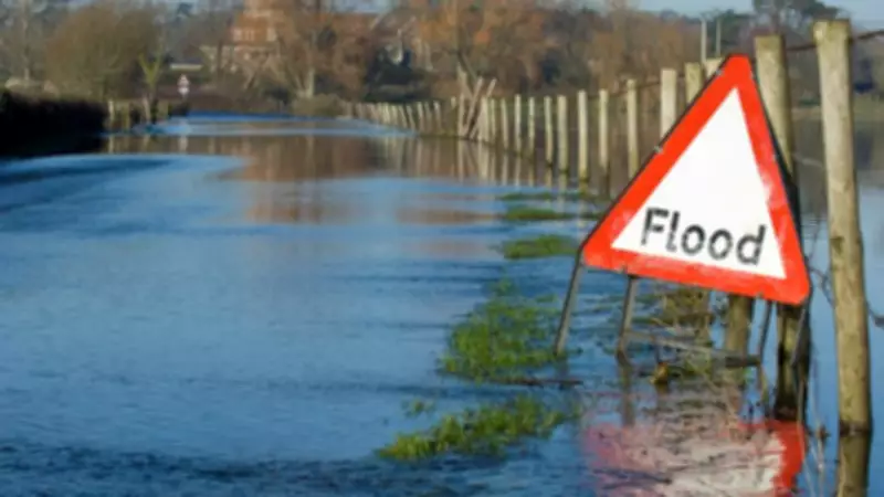
Flood Warnings and Alerts in Force Across England
Currently, there are 75 active flood warnings in place across England, indicating that flooding is expected in these areas. In addition, the Environment Agency has issued 206 flood alerts, where flooding is considered possible. These warnings come as part of a broader effort to manage the risks associated with the ongoing poor weather, which has already impacted thousands of properties.
Jonathan Day, the flood duty manager at the Environment Agency, reported that more than 24,000 homes and businesses have been protected from flooding through various measures. However, approximately 330 properties have unfortunately been flooded, highlighting the severity of the situation. The agency continues to monitor river levels and deploy resources to vulnerable regions.

Yellow Ice Warning Persists in Northern Regions
While a series of snow and ice warnings expired over the weekend, a yellow ice warning remains in effect until 10am on Monday, covering eastern Scotland and north-east England. The Met Office has cautioned that ice forming on untreated surfaces could lead to difficult travelling conditions, including the risk of black ice and slippery roads.
According to the warning, temperatures are expected to fall below freezing as skies clear from the west through Sunday evening and overnight. This rapid temperature drop following rain and hill snow will create hazardous conditions, particularly on untreated pavements and roadways. The public is advised to take extra care when venturing outdoors.
Weather Forecast: From Sunny Spells to Further Disruption
Met Office operational meteorologist Dan Stroud provided an update on the weather outlook, noting that Monday will feature sunny spells and blustery showers. However, the situation is set to deteriorate later in the week. Overnight Monday into Tuesday will bring a frosty start, with largely dry conditions and winter sunshine during the day.
By late Tuesday, a broad area of cloud and rain will push into south-west England and South Wales, spreading across the UK on Wednesday. This system is expected to bring a mix of rain, sleet, and hill snow, prompting concerns about further disruptions. Mr. Stroud emphasized the need to monitor this system closely, as it may lead to additional snow warnings being issued.
Looking ahead, Thursday into Friday are forecast to be largely dry with clear skies, with temperatures turning milder towards the end of the week. Despite this temporary respite, the Environment Agency and Met Office urge continued vigilance, as weather patterns remain unpredictable and potentially dangerous.