New Zealand Battles Severe Storms and Widespread Flooding
A deep area of low pressure situated to the south-east of New Zealand's North Island swept into the region on Sunday, unleashing a barrage of heavy rain, gale-force winds, and dangerous coastal swells that lashed exposed shorelines. The intense storm system triggered widespread power outages, forced numerous evacuations, and caused significant damage to critical infrastructure across affected areas. Further impacts are anticipated on Monday as the system lingers temporarily before tracking southwards later in the day.
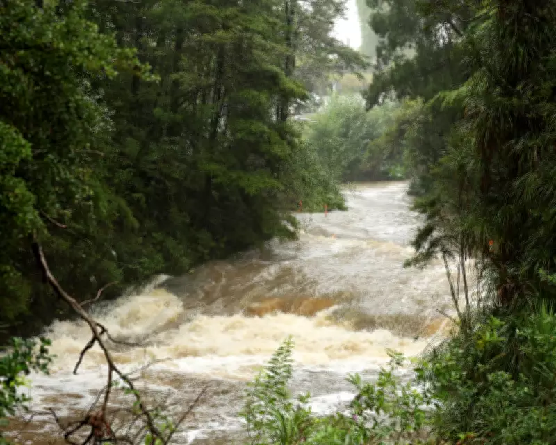
Compounding Flood Risks in Saturated Regions
The storm's arrival followed days of extensive flooding in the Ōtorohanga district, where a man was tragically found dead after his vehicle became submerged in flood waters. Some regions recorded more than 100mm of rain within a 24-hour period on Thursday, with Gisborne, Hawke's Bay, and the Bay of Plenty bearing the brunt of the deluge. The Tararua district and Wairarapa have also been experiencing heavy rain and strong winds from the storm, with local 24-hour rainfall totals exceeding 100mm and wind speeds reaching approximately 80mph (130km/h) along coastal parts.
This unusually persistent weather system developed when a cold front tracking east across the country late last week merged with a strengthening low-pressure system offshore, causing it to deepen significantly. It then became trapped between two blocking high-pressure systems, stalling in place and subjecting the same communities to prolonged periods of heavy rainfall. A humid air mass of tropical origin has fed additional moisture into the storm, further intensifying the downpours. The low is now looping back on itself, a movement that continues to funnel rain bands over already saturated areas, compounding the risk of further flooding and landslides.

Storm Nils Ravages Western Europe
Meanwhile, Storm Nils battered western Europe last week with what Météo-France described as "uncommon strength", resulting in two fatalities in France and cutting power to about 900,000 homes. Flood alerts remained active across south-west France, while red alerts were issued in northern Spain, including Galicia, Cantabria, and the Basque Country. Winds of up to 100mph lashed France's Atlantic coast and the Alps, significantly increasing avalanche danger in Alpine ski resorts. In the Italian Alps, unstable snowpack has been blamed for a number of deaths, including incidents in areas close to Winter Olympics venues, though locations remained open under close monitoring.
In Portugal, a motorway bridge collapsed after the Mondego River burst its banks following weeks of relentless rain that left soils saturated and rivers swollen. Transport networks across Spain, France, and Portugal were heavily disrupted, with widespread flight cancellations and rail delays amid flooding and high winds. The storm was intensified by a pronounced southward dip in the jet stream, steering a powerful Atlantic low into western Europe. As mild moisture-laden ocean air collided with colder continental air, the sharp temperature contrast fuelled the system. Rapid uplift generated intense rainfall at lower elevations and heavy snowfall over the Alps, where fresh snow and strong winds substantially increased avalanche risks.