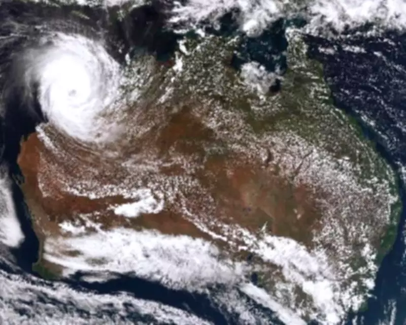
The Bureau of Meteorology has released satellite imagery and tracking maps showing Tropical Cyclone Narelle's progression over Western Australia. This massive weather system is forecast to strike the Western Australian coastline on Friday night as a severe category 3 cyclone, bringing significant impacts to coastal communities.
Cyclone Path and Intensity Forecast
According to the latest Bureau of Meteorology forecasts, Tropical Cyclone Narelle is expected to intensify to a category four storm while positioned off the Western Australia coast. The system is then predicted to cross the coastline as a category 3 cyclone, with the tourism town of Denham in Shark Bay likely to experience the most direct impacts from the landfall.
Remarkable Cross-Continental Journey
This cyclone has undertaken an extraordinary journey across Australia, having initially impacted far north Queensland last week before moving over the Northern Territory. The storm system then continued westward across the continent before reaching the Indian Ocean. By the time Tropical Cyclone Narelle approaches Perth, it will have traveled more than 5,500 kilometers (approximately 3,400 miles) across Australian territory.

Potential Impacts on Western Australia
While earlier forecasts suggested Perth might be directly in the cyclone's path, more recent predictions have shifted the system's trajectory further north and east of the Western Australian capital. However, metropolitan Perth could still experience significant weather effects from the system, with forecasts indicating approximately 50 millimeters of daily rainfall on both Friday and Saturday.
The Bureau of Meteorology continues to monitor Tropical Cyclone Narelle closely and will provide regular updates to tracking maps and forecasts as the situation develops. Residents in affected areas are advised to stay informed through official channels and prepare for potentially severe weather conditions.