A simmering border conflict between Thailand and Cambodia, which flared up again in the summer of 2025, has roots stretching back over a century to the era of European colonial rule. The dispute, often described by historians as a "sibling rivalry", is fuelled by competing claims to ancient cultural heritage and lines drawn on old maps.
The Colonial Legacy: How Maps Redrew a Border
The origins of the modern dispute lie in the early 20th century when France occupied Cambodia as part of French Indochina. At that time, the frontier with Thailand, then known as Siam, lay further south, making Cambodia smaller than its present size.
A series of treaties between France and Siam dramatically reshaped the landscape. The 1904 Franco-Siamese treaty began redefining the border, using a natural ridge-line as a key marker. This was followed by the more substantial 1907 treaty, under which Siam ceded the provinces of Battambang, Siem Reap and Sisophon to French Indochina.

These agreements pushed the frontier northwards, establishing much of the modern border and significantly expanding Cambodian territory. Crucially, this meant the border region became dotted with ancient Khmer stone temples, now claimed by both nations.
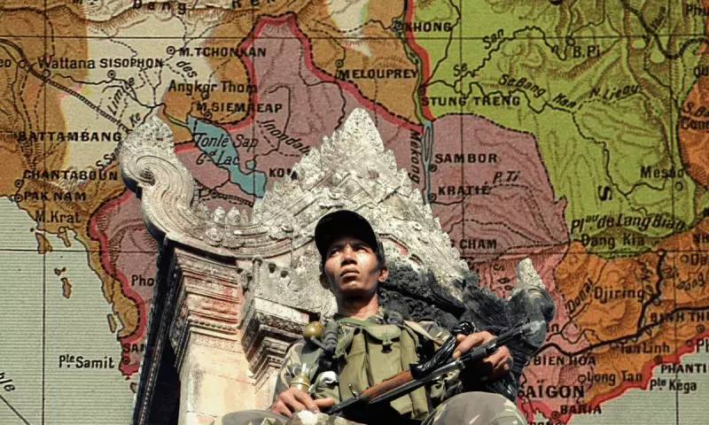
The Flashpoint: Three Temples and a Contested Map
Moving the border north to follow the Dangrek escarpment placed several important temples near the new line. However, the treaties left their exact ownership ambiguous, with different historic maps cited by each side.
Three temples along this escarpment are central to the dispute: Prasat Ta Moan Thom (Ta Muen Thom), Prasat Ta Khwai (Ta Krabey), and most notably, Preah Vihear (Khao Phra Viharn in Thailand). This 11th-century Hindu temple, which predates Angkor Wat by a century, sits on the edge of the escarpment and has been the focal point of tensions for decades.
The modern conflict stems from a 1907 French-produced map, known as the Annex I map, which placed Preah Vihear on the Cambodian side. Historian Shane Strate of Kent State University notes that while the map's boundary largely followed the watershed of the Dangrek range, it "veers off course to enclose the ancient temple within French colonial territory" before rejoining the watershed line.
Siam did not formally object at the time, a silence that later proved pivotal. After Cambodia gained independence in 1953, the dispute escalated to the UN's International Court of Justice (ICJ). In 1962, the ICJ ruled that the temple belonged to Cambodia, heavily relying on Siam's lack of objection to the 1907 map.
An Unresolved Rivalry: Why Peace Remains Elusive
The 1962 ICJ ruling failed to resolve the broader conflict. It did not clarify ownership of the contested area surrounding the temple, leaving a vacuum that arguments continue to fill.
Thailand maintains that the border should follow the watershed line referenced in the original treaties, which would place Preah Vihear and nearby territory on its side. This position conflicts directly with the Annex I map that Cambodia uses to assert its claim. Control of the surrounding land is also economically significant, as it affects road access for tourists, who historically visited the temple from the Thai side.
According to historian Chris Baker, based in Thailand, the old maps and treaties are often exploited by governments with competing political and economic agendas. "While the varying maps are in existence and can be invoked in these disputes, I don't think this dispute is about the border," Baker said. "The other factor is the longstanding sibling rivalry of the two countries, so fierce precisely because they are so similar."
With both nations continuing to rely on differing historical documents and interpretations of the same rugged terrain, Preah Vihear and its neighbouring temples are likely to remain dangerous flashpoints. The century-old dispute, born from colonial cartography and nurtured by deep-seated national pride, shows little sign of a permanent resolution.