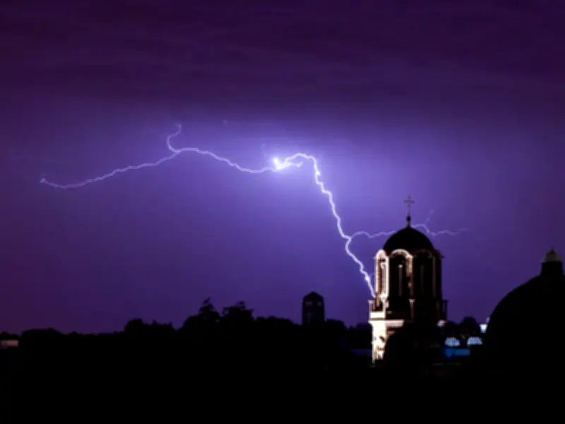
Parts of London experienced another thunderstorm overnight on Friday, June 26, as temperatures remained high. Lightning illuminated the sky over Sutton, Chelsea, and Enfield around 4am on Saturday, June 27, according to resident reports.
Met Office Warning and Impact
The Met Office had issued a six-hour thunderstorm alert for the early hours, warning of frequent lightning and heavy rain across East of England, London, and South East England until 8am. Potential damage to buildings and disruption to train services were expected. This follows a similar storm earlier in the week that caused flash flooding in streets and Tube stations, prompting over 400 calls to London Fire Brigade.
Previous Storm Damage
The earlier storm is believed to have sparked a house fire in Tooting on Wilde Place, damaging the roof of a semi-detached house and a small adjoining section. Firefighters spent over an hour battling the blaze. It remains unclear if the latest storm caused any damage.

Resident Reactions
Residents shared their experiences on social media. One person posted on X: "What a way to end a heatwave. 4am to 5am, there were several lightning flashes in Camberwell." Another wrote: "Storm over Chelsea, London, this morning at 4am. At least it watered the plants and gardens." Some were shocked awake, with one saying: "We’ve gone from the most disgusting heat to the loudest thunder I’ve heard in my life." A second remarked: "I've lived in London for 13 years and I never knew this city could have thunder," while a third joked: "We must sacrifice another prime minister to appease the angry thunder gods."
Weather Context and Climate Change
Thunderstorms often follow heatwaves due to atmospheric instability, as very warm air near the surface sits beneath cooler air higher up. The Met Office explained: "During periods of hot, humid weather, especially after a few days of strong sunshine, the ingredients for this instability are often in place."
Temperatures are expected to drop after a heatwave that saw the UK's June temperature record broken three days in a row. Friday was confirmed as the hottest June day on record, with a provisional 37.3°C in Santon Downham, Suffolk, surpassing Thursday's 36.7°C in Merryfield, Somerset. These smashed the 1976 record by over 1°C. Scientists warned such heat would have been virtually impossible 50 years ago, with human-driven climate change fueling more intense extreme heat events.
Forecast and Warnings
An amber extreme heat warning remains in place until 9pm on Saturday across southeast England and East Anglia. Met Office chief forecaster Andy Page said: "The UK is seeing a gradual shift in conditions over the weekend, with those to the southeast of England retaining the warmth the longest, where an amber extreme heat warning remains in force through much of Saturday, though peaks are more likely to be in the low 30s Celsius." Next week will bring a mix of cloudy and sunny spells, with rain from the west at times, the Met Office added.