Severe Weather Alert: Northern UK Braces for Powerful Easter Weekend Winds
The Met Office has escalated concerns by issuing a yellow weather warning for intense gale-force winds expected to sweep across the northern half of the United Kingdom during the Easter weekend. This severe weather event, forecast to unfold from Saturday evening through to midday on Sunday, poses significant risks of travel chaos, power outages, and potential structural damage.
Forecast Details and Impact Zones
Meteorologists predict that wind gusts will range from 50 to 60 mph across many areas, intensifying to 60-70 mph in exposed locations. Particularly vulnerable western regions of Scotland could experience devastating gusts peaking at 80-90 mph. The warning encompasses Scotland, Northern Ireland, and sections of north Wales and northern England, highlighting a broad swath of the country under threat.
Dan Holley, the Met Office's deputy chief meteorologist, explained the atmospheric dynamics behind this event. "A significant cold plunge from Canada into the north Atlantic will impact our weekend weather, strengthening the jet stream and spinning up a deep area of low pressure towards the north-west of the UK on Saturday night," he stated. "This will lead to a spell of very strong winds later on Saturday and overnight into the morning of Easter Sunday."

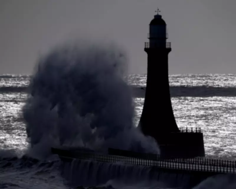
Potential Disruptions and Safety Concerns
The anticipated severe winds are likely to cause extensive disruptions across multiple sectors. Travelers should prepare for delays and possible cancellations affecting road, rail, air, and ferry services. High-sided vehicles may face hazardous conditions on exposed routes and bridges, with some closures anticipated. Additionally, there is a heightened risk of power cuts and interruptions to mobile phone coverage, alongside damage to buildings such as roof tiles being dislodged.
Coastal areas are under particular scrutiny, with forecasters warning of a small chance of injuries due to large waves and beach material being hurled onto seafronts, coastal roads, and properties. Residents in these zones are urged to exercise extreme caution.
Broader Weather Context and March Climate Data
This warning comes amid a backdrop of unsettled weather patterns as the UK approaches Easter. Thursday is expected to start dry before rain and strengthening winds move into the northwest later in the day. Good Friday will see showery outbreaks with brighter intervals, though conditions will remain blustery, especially around the Pennines.
Despite the impending storm, Tom Morgan, an operational meteorologist at the Met Office, offered a nuanced perspective. "While much of the UK will experience 'unsettled' weather by the end of the week, it does not necessarily point to a washout of an Easter weekend," he remarked, suggesting some variability in conditions.
Separately, recent Met Office data revealed that March was provisionally one of the warmest on record for England and Wales, driven by prolonged periods of above-average temperatures and sunshine. Wales recorded its joint fourth warmest March, while England saw its joint sixth warmest since records began in 1884. The UK overall experienced its joint tenth warmest March.
Rainfall patterns in March exhibited a pronounced north-south split, with southern England receiving 37% less than the long-term average, whereas northern England and Scotland recorded 14% and 19% above average rainfall, respectively. This disparity underscores the regional climatic variations currently influencing weather events across the nation.