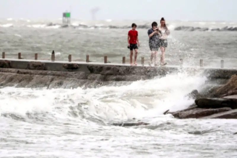
Heavy surf stirred up by Tropical Storm Arthur battered the beach in Surfside, Texas, on Wednesday, as people walked on the jetty amid the powerful waves. The storm, which was downgraded from a cyclone to a low pressure area along the upper Texas coast, made landfall and lost wind intensity on Thursday.
Forecasters Warn of Life-Threatening Flooding
Despite the downgrade, forecasters expect the storm to cause life-threatening flooding, property damage, and disruptions to commerce and travel. The National Hurricane Center in Miami predicts several inches of rain across the southeastern United States into Friday.
Arthur is the first tropical storm of the season in the Atlantic basin. It is expected to continue weakening as it moves across southeastern Texas and western Louisiana before crossing the southeastern US. Maximum sustained winds were about 35 mph (55 km/h). All coastal watches and warnings were discontinued on Wednesday, but flooding is likely through Friday over parts of Texas, Louisiana, Mississippi, Georgia, and the Florida Panhandle.

Preparations Underway in Affected Areas
Some communities in Louisiana and Mississippi have been distributing sandbags to residents and clearing debris from drainage systems ahead of the storm. The National Hurricane Center director, Michael Brennan, stated, "The main threat from Arthur is going to be a prolonged, multiday, heavy rainfall event that could produce dangerous to life-threatening flash flooding."
Dan DePodwin, AccuWeather vice-president of forecast operations, added, "A significant flood risk exists each day this week, shifting slowly eastward from Texas into Wednesday to Louisiana, Mississippi, Alabama, and Georgia during the second half of the week." Rainfall totals are expected to be 5-10 inches (13-25 cm), with isolated higher totals near 20 inches.
High Risk for Excessive Rainfall
The National Weather Service weather prediction center issued a High Risk for Excessive Rainfall for portions of the Central Gulf Coast, stating, "High Risks are not issued lightly & indicate the potential for both widespread & life-threatening flash flooding. NEVER walk or drive into flood waters. Turn around, don't drown!"
Swells generated by the storm are expected to cause life-threatening surf and rip-current conditions along the northwestern Gulf coast over the next couple of days, with tornadoes possible through Thursday.