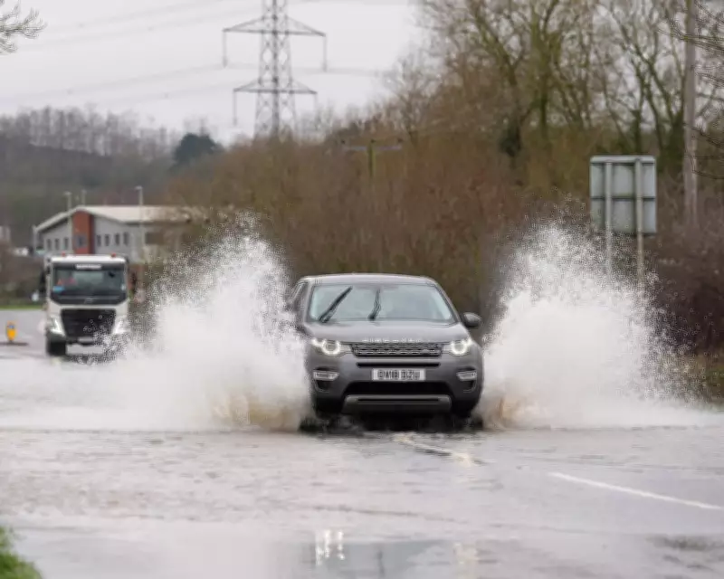
The United Kingdom remains under a deluge of wet weather, with extensive flood warnings and alerts in place across multiple regions. Motorists in Leicestershire faced significant challenges last week as roads between Quorn and Mountsorrel were inundated, creating hazardous driving conditions. This persistent rainfall shows no signs of abating, with forecasts predicting continued precipitation and potential snowfall in the far north.
Flood Warnings and Alerts Across the Nation
The Environment Agency has escalated its response to the ongoing weather crisis by issuing 73 official flood warnings, primarily concentrated in the south-west of England and the Midlands. These warnings indicate that flooding is expected and immediate action is required. Additionally, 177 flood alerts have been activated across England, signaling possible flooding that requires vigilance from residents and authorities.
In Wales, Natural Resources Wales has implemented two flood alerts for South Pembrokeshire and the Lower Severn catchment area in Powys. These measures reflect the widespread nature of the weather system affecting the British Isles, with water levels rising in numerous river basins and low-lying areas.

Detailed Weather Forecast and Predictions
The Met Office has provided a comprehensive outlook for the coming days, indicating that blustery showers will spread across many regions overnight on Sunday, accompanied by chilly temperatures and potential frost in northern areas. Monday is expected to bring a mix of sunny spells and showers, with some rainfall potentially turning heavy and accompanied by hail and thunderstorms.
Northern regions should prepare for snow showers, while Tuesday is forecast to be largely drier and brighter across most of the country. However, the respite may be temporary, as Wednesday and Thursday could bring rain and snow to southern areas, though northern regions are expected to remain mostly dry during this period.
While no weather warnings are currently in place beyond the flood alerts, the Met Office has cautioned that conditions may evolve rapidly later this week, potentially necessitating additional warnings as the situation develops.
Historical Context and Recent Weather Patterns
The current wet weather follows an exceptionally rainy period across the United Kingdom. Provisional statistics released by the Met Office earlier this month revealed that Northern Ireland experienced its wettest January in 149 years, marking the second wettest January on record for the region. Southern England also recorded its sixth wettest January since records began in 1836.
Remarkably, parts of Devon, Cornwall, and Worcestershire endured rainfall for 40 consecutive days, according to Met Office data. This relentless precipitation has been compounded by a series of named storms—Goretti, Ingrid, and Chandra—that brought widespread flooding to several regions including Devon and Somerset, causing significant disruption to both residents and businesses.
Long-Term Outlook and Weekend Predictions
The wet weather pattern shows no signs of easing as we approach the weekend. Longer spells of rain are predicted to continue into Friday and throughout the weekend, maintaining the unsettled conditions that have characterized recent weeks. The Met Office anticipates that while there may be some drier intervals between weather systems, these periods are likely to be brief before the next wave of precipitation arrives.
This persistent rainfall has led many to observe that traditional seasonal patterns have become increasingly confused, with winter months delivering unprecedented amounts of precipitation that challenge infrastructure and daily life across the country.