An old English saying warns: “Mare’s tails and mackerel scales make lofty ships to carry low sails.” This adage about summer skies has proven accurate for centuries, as both cloud types signal the arrival of a warm front or low-pressure cyclonic storm system.
What Are Mackerel Skies?
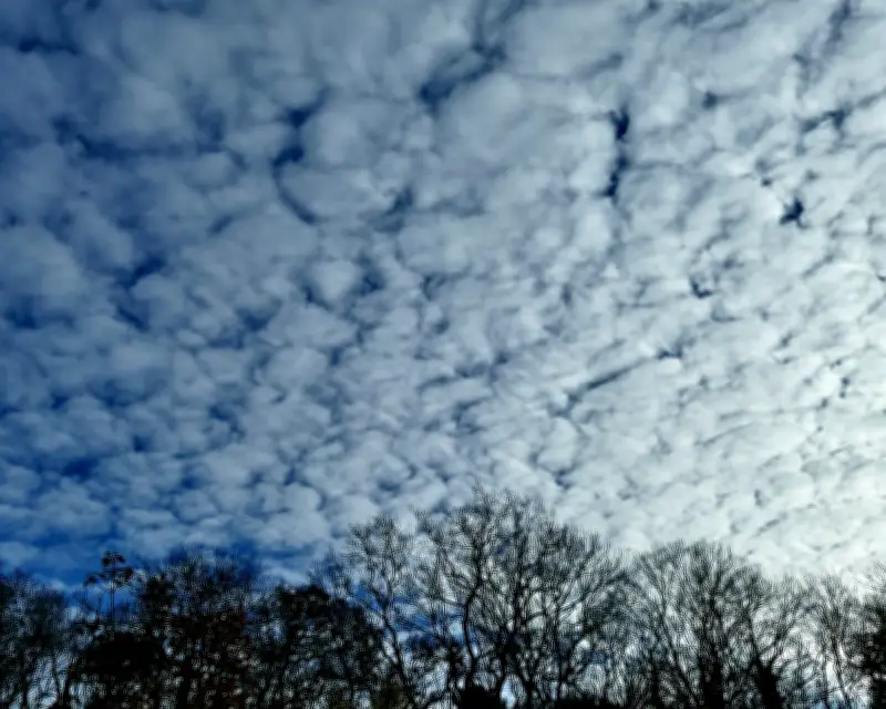
Mackerel skies feature cirrocumulus or altocumulus clouds arranged in regular but patchy rows, resembling the light and dark scale pattern on a mackerel fish. Cirrocumulus clouds appear white and wispy, while altocumulus are grey and thicker. A simple rule: cirrocumulus clouds are narrower than a finger held at arm’s length, whereas altocumulus span about three fingers. These clouds form as a warm front advances, pushing moisture to high altitudes and creating turbulence that results in these distinctive patterns.
Understanding Mare’s Tails
Mare’s tails, scientifically known as Cirrus uncinus or “curly hook,” are high-altitude clouds composed of ice crystals. They feature a dense, comma-shaped head trailing a series of fainter, swept-back plumes, closely resembling a horse’s tail. These clouds form when ice crystals are swept into long faint plumes by variations in wind speed at different altitudes. Like mackerel skies, mare’s tails indicate the imminent arrival of a warm front or storm system.
Historical Accuracy of the Saying
The old saying holds true: sailors of tall ships were wise to lower their sails upon seeing these warning clouds, reducing sail area to avoid being overbalanced by strong winds. Both cloud types serve as reliable indicators of approaching weather changes, particularly during summer months in England.