The Met Office has issued a fresh series of yellow weather warnings for snow and ice across the United Kingdom this weekend, as a new band of cold air sweeps in following the disruption caused by Storm Goretti.
Weekend Forecast: From Frost to Further Snow
Forecasters warn that while Saturday, 10 January 2026, will bring sunnier and drier conditions for many, it will also usher in a severe frost overnight. This will lead to icy stretches on untreated roads and pavements. The respite will be short-lived, however.
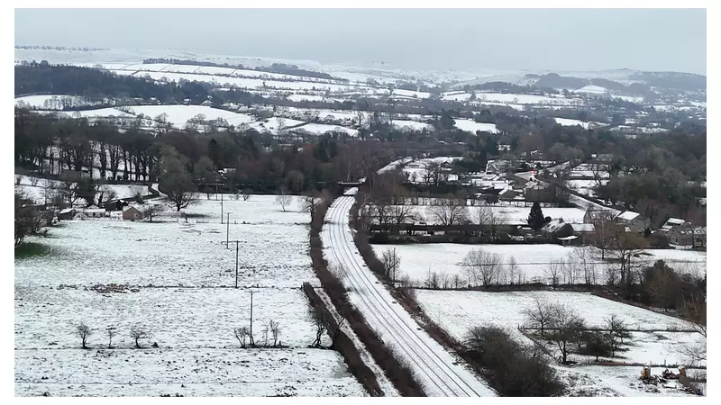
A band of rain is expected to move in from the west in the early hours of Sunday. As this moisture meets the entrenched cold air, it creates a widespread risk of snow. The Met Office predicts that snow is especially likely across Scotland, where higher ground could see accumulations of 10 to 20cm (4 to 8 inches). Lighter falls are possible elsewhere.

Warnings in Force Across the Nations
A complex pattern of alerts is in place. On Saturday, yellow warnings for snow and ice covered:
- Most of Scotland and parts of northeast England until 3pm.
- Northern Ireland until 11am.
- Large parts of southern, western, and northwestern England, the East Midlands, and Wales until midday.
Looking ahead to Sunday, a further yellow warning for snow and ice is in force from 2am until 3pm. This alert covers a large swathe of northern England and virtually all of Scotland.
Aftermath of Storm Goretti
The latest cold snap follows a day of significant disruption on Friday caused by Storm Goretti. The storm brought a potent mix of heavy rain, snow, and strong winds to much of the country.
The impacts were severe:
- Tens of thousands of homes were left without power.
- Gale-force winds brought trees down, with one falling on a house in Falmouth, Cornwall.
- Travel was heavily disrupted, with some flights cancelled and dramatic footage emerging of a passenger plane battling strong gusts while landing at Heathrow Airport.
- Drivers faced hazardous conditions, with cars left stuck in snow in areas like Derbyshire.
Sky News Weather presenter Jo Wheeler summarised the transition: "Storm Goretti slopes away eastward tonight leaving a much quieter picture for Saturday. However, the cold air returns... Meeting the cold air, there's the potential for some short-lived disruptive snow."
Temperatures and Looking Ahead
Temperatures will remain low on Saturday, typically between 2 to 3C (35 to 37F). A slight rise is expected on Sunday, potentially reaching 10C (50F) in western areas and Northern Ireland. This milder air will eventually take over, leading to less dramatic conditions next week, though it also brings a risk of localised flooding as snow melts.
Authorities are urging the public to stay updated with the latest local forecasts and to take extra care when travelling during the warning periods.